




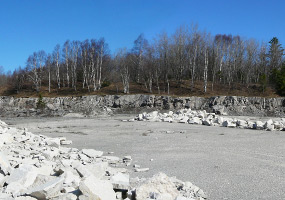
The Rexton Project will initially involve surface quarries and, in the future, an underground mine. Our exploration program in the region has located limestone of both suitable quality and quantity, and we are now securing the rights to the land, as well as proceeding with applications for the required permits. Exploration may continue, as needed, to further characterize the limestone in the Rexton Project areas.
Click the button below to continue reading about the application on the Michigan Department of Natural Resources (DNR) website.
Visit WebsiteMDNR Land Transaction Following a recommendation from senior department officials, DNR Director Keith Creagh approved the Graymont land transaction application during meeting of the Natural Resources Committee held in Roscommon, MI This land transaction application approval authorized the following land and /or mineral transactions
Reduction of ~84% from original November 2013 proposal
Surface ownership remains with MDNR
Similar value land provided in exchange


• 1,007 Acres as direct sale
• 671 Acres transferred as an exchange for land of equivalent value.
transferred as an exchange for land of equivalent value.
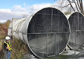
Direct purchase of sub-surface interests and rights to make limited use of the surface to support underground mine operations (Ventilation, mine access, etc.).
• State retains ownership of the surface.
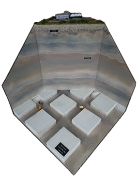
Underground Mine Model
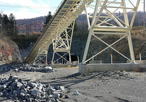
To support transportation within the project area.
Direct purchase of land adjacent to the underground mine area.

Graymont also submitted an application to the MDNR proposing an exchange of mineral rights involving areas in the Hendricks and Trout Lake townships. This exchange was completed March 26, 2015.
As per the application, Graymont transferred its mineral rights on approximately 1718 acres under State owned forest land near the Fiborn Quarry. The State already owned the surface of these properties and wished to consolidate its ownership interests, by owning both the surface and the mineral rights.
The State transferred mineral rights on an equivalent area, approximately
1712 Acres,
located in the Hiawatha National Forest to Graymont.
The surface of these properties is
owned by the Federal Government,
represented by the USFS.
Of the total area will be at the surface.
There will be no more than 400 Acres of active surface mining at any time. (Including areas under undergoing active reclamation).Quarry development is expected to advance around 10-20 acres each year. Mined areas will be reclaimed concurrently as the quarry progresses.
Of the total area is mineral rights only, and in the proposed underground area.
The state will continue to own & maintain the surface.

Designation of 50 acres within the Hendricks Quarry area was made with the MDNR on December 23, 2015 and associated local and state authorizations are in process. This designation will allow initial operation to be established for extraction, testing and future processing limestone from the project area.
Underground mining would involve minimal surface disturbance and visibility in the project area.
Only activities that directly support the underground mining process (Access Points, Ventilation, etc…) will be visible on the surface. This area is not expected to exceed 400 acres.